GPS columns in the Packets view
In the Packets view of a capture window, you can show GPS data by displaying one or more columns related to GPS. Simply right-click an existing column head and select one of the GPS columns described in the table below.
|
Column
|
Description
|
|---|---|
|
GPS Time
|
Displays the time reported by the GPS receiver for the fix associated with this packet.
|
|
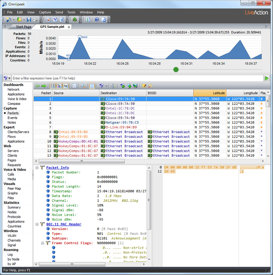
Latitude
|
Displays the latitude portion of the GPS fix associated with this packet, reported (N, north or S, south) in degrees, minutes, and decimal fractions of a minute.
|
|
Longitude
|
Displays the longitude portion of the GPS fix associated with this packet, reported (E, east or W, west) in degrees, minutes, and decimal fractions of a minute.
|
|
Altitude
|
Displays the altitude portion of the GPS fix associated with this packet. Reported in the measurement system appropriate to the local settings associated with the user in the operating system. (US users in feet, all others in meters.)
|
|
Speed
|
Displays the speed portion of the GPS fix associated with this packet. Reported in the measurement system appropriate to the local settings associated with the user in the operating system. (US and UK users in miles per hour, all others in kilometers per hour.)
|
The following figure shows an example of the latitude and longitude columns in a capture window:
The GPS columns remain blank until GPS data is available. Once GPS data becomes available, the columns will show either GPS data or N/A. During capture, data is posted to these columns as it is passed from the GPS receiver by the LiveAction GPS Daemon.
GPS receivers typically send a new fix every one or two seconds. The capture window will continue to use the last valid fix for a short interval. When the next fix is posted, the capture window will begin using this new fix for all captured packets. If the new fix is based on NMEA sentences flagged as invalid by the GPS receiver, the capture window will show N/A in the GPS columns.
If a new fix is not presented within the time-out (a few seconds), the capture window will also begin to show N/A for all GPS columns. This can happen for any number of reasons. One of the most common causes is that the GPS receiver has temporarily lost contact with the satellites.
TIP: GPS receivers usually have their own integrated display. Each time they get a new fix, they typically send the data to the attached computer first, then update their display. If you are moving fast enough, you may notice some slight lag between the updates of the GPS display and the computer screen.
The native format of GPS data for distance, speed, and altitude is expressed in metric or SI units (based on the meter). Omnipeek checks the operating system settings for the current user to determine which system of measurement is appropriate. If the local settings for the user indicate that the U.S. system of measurement should be used, then Altitude is displayed in feet and Speed is displayed in miles per hour. For a user in the UK, Altitude is in meters and Speed is in miles per hour. For all other users, Altitude is in meters and Speed is in kilometers per hour.
NOTE: Conversion to another measurement system is performed before data is posted to the capture window. When you save packets to a capture file, GPS data is saved in whichever measurement system is in use by the capture window. Omnipeek does not convert between measurement systems when opening a capture file.